
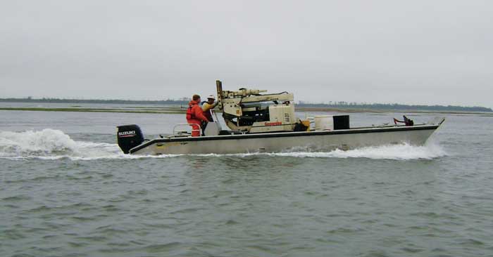
The Geoprobe® 66DT is easily transported by boat to a remote barrier island.
The Virginia Institute of Marine Science (VIMS) uses their 66DT to dig up the past – literally – along Virginia’s Eastern Shore barrier islands.
“The power of the Geoprobe® 66DT not only allows us to core deeper (we consistently are collecting 60 ft. to 80 ft. cores) but the sturdy track undercarriage also allows us to easily mobilize and work on the beaches and dunes themselves,” said Coastal Geologist Christopher Hein. “As a result, we have been able to collect the deepest geologic samples ever collected on Virginia’s barrier islands, greatly expanding our knowledge of these islands, and more generally, how stable beaches are in the face of sea-level rise.”
VIMS, in partnership with Randolph-Macon College and the University of Delaware at Newark, are studying the Holocene geology (last 11,000 years) of the barrier islands. This includes Wallops Island where the NASA Wallops Flight Facility and Virginia’s Mid-Atlantic Regional Spaceport are located. The goal is to better understand why the islands are situated where they are, how they have formed and changed over time, and how stable/resilient they are to sea-level rise.
Contact Us
1835 Wall Street
Salina, Kansas 67401
Phone: (785) 825-1842
The Geoprobe® 66DT is easily transported by boat to a remote barrier island.