
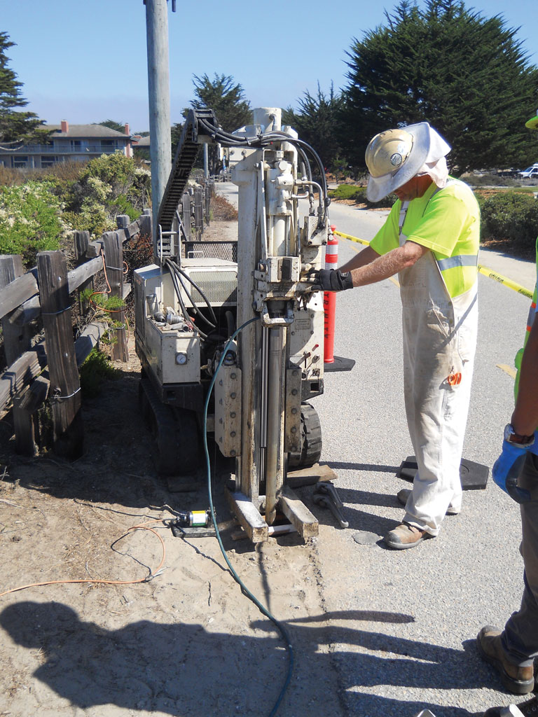
One MiHpt location (MIP-14) was within the active Monterey Bay Coastal Recreational Trail. Jeff Edmonds, with ECA, operates a Geoprobe® 54LT at this location in order to minimize the impact to the trail and its users.
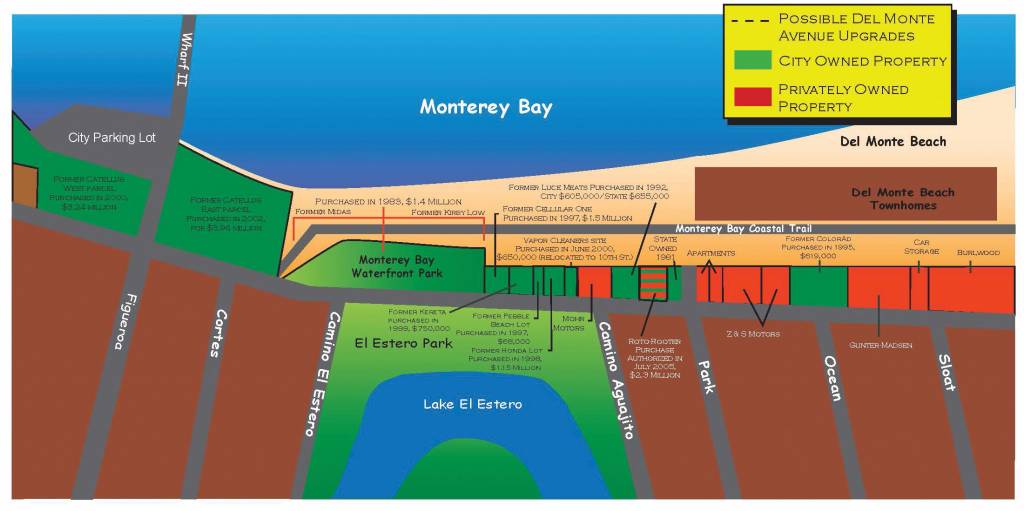
The City of Monterey, CA, has envisioned providing public access to the City’s waterfront by acquiring open space since the creation of the City’s Master Plan in 1939. One of those efforts is the Window on the Bay water front park project, which prompted the city to purchase a former dry cleaning facility that had operated nearly 80 years.
The facility used both Stoddard solvent and tetrachloroethene (PCE). PCE was discovered in 1986 during excavation of a water main near the north end of the site. Subsequent investigations identified a residual groundwater plume of chlorinated volatile organic compound (CVOC), and Stoddard solvent, both originating at the site. These impacts have migrated to adjacent parcels which are also part of the Window on the Bay water front park.
On behalf of the City, Trinity Source Group, an environmental consultant in Santa Cruz, CA, evaluated the existing site data in order to prepare a Remedial Action Plan (RAP). Based on historical groundwater data, intrinsic reductive dechlorination has been occurring to a significant degree at the site. Trinity’s proposed remedial action is to supplement the existing intrinsic biodegradation, using enhanced reductive dechlorination (ERD) to address remaining source area mass reduction in the aquifer underlying the site.
Trinity’s review of the site data identified data gaps that needed to be addressed prior to completion of the remedial design, which included:
- Utility lines through the plume area may present preferential pathways for contaminant migration, including the main sewer lateral from the former dry cleaners.
- The vertical distribution and concentrations of contaminants in the saturated zone.
- The current areal extent of the plume in the vicinities of monitoring wells MW-6 and MW-7 were not defined.
- Lack of information regarding local aquifer characteristics.
The Geoprobe® Direct Image® MiHpt system was selected to profile the current three dimensional extent of the plume. Subsequently, direct push borings were used to collect soil and grab groundwater samples in order to confirm MIP results inside and outside the CVOC plume. Boring locations were determined in the field based on a review of the MiHpt field results.
Trinity teamed with Environmental Control Associates (ECA) of Santa Cruz, CA (drilling contractor), and ASC Tech Services (ASC) of Rancho Cordova, CA (Direct Image® service provider) to complete MiHpt pushes and subsequent soil and groundwater sampling.
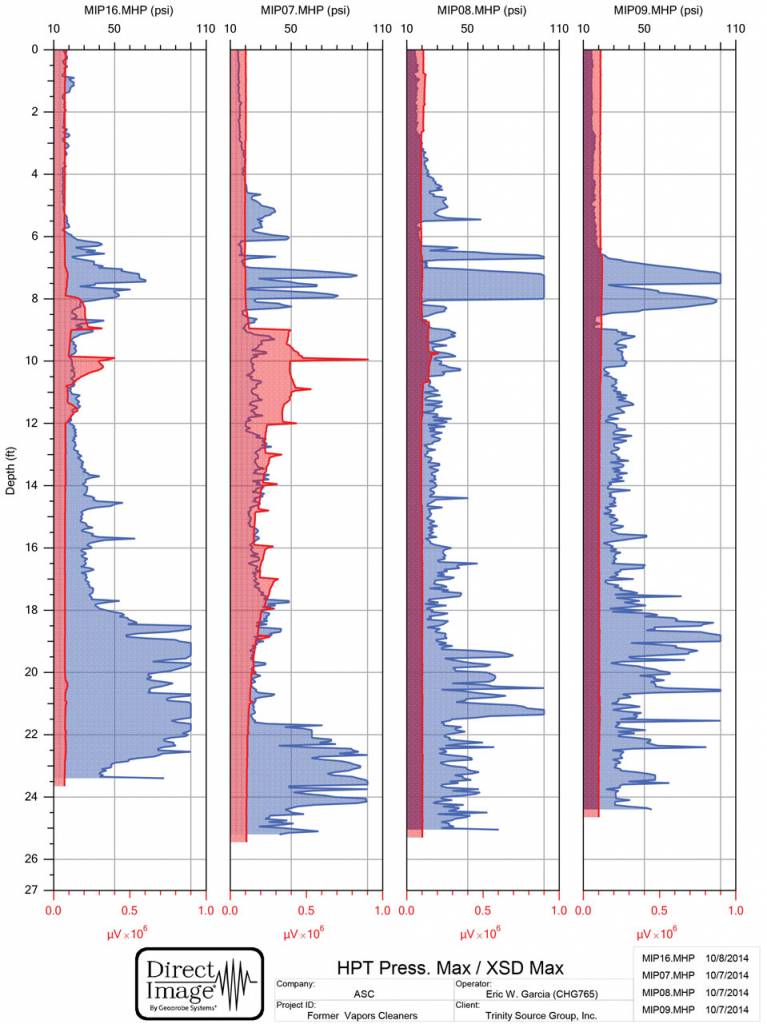
According to Eric Garcia, President and Principal Geologist for ASC, after the MiHpt logs were run and reviewed, the MIP data did not show evidence for CVOC impacts in the unsaturated zone. “We found evidence for CVOCs in the saturated zone across some depth intervals in several of the MiHpt locations, expressed as elevated XSD responses often with corresponding elevated PID responses,” Garcia explained. “Elevated FID responses in these same zones and corresponding depth intervals without evidence for CVOCs may indicate the presence of methane, produced as a by-product of ongoing CVOC reductive dechlorination.” More detailed interpretation of the MiHpt data is provided under the log above.
Based on the information the field team collected, Trinity concluded that the site was adequately assessed for purposes of groundwater remediation.
The Remedial Action Plan for the project has been approved for implementation by the Central Coast Regional Water Quality Control Board.
Contact Us
1835 Wall Street
Salina, Kansas 67401
Phone: (785) 825-1842
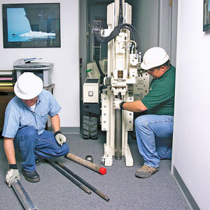
Photo Gallery
One MiHpt location (MIP-14) was within the active Monterey Bay Coastal Recreational Trail. Jeff Edmonds, with ECA, operates a Geoprobe® 54LT at this location in order to minimize the impact to the trail and its users.
This cross section of MiHPT logs from Monterey, CA, located just south of the Monterrey Bay Coastal Recreation Trail shows the HPT pressure graph (blue) overlaid by the MIP-XSD response (red). Most of the CVOC contamination extends from 8 to 12 feet in this cross section of logs and is seen in logs MIP-16, 07 and 08 (left to right) with MIP-07 showing the highest impacts. These impacts are present in the higher permeability soils (lower HPT pressure) just below a high HPT pressure zone (low permeability)
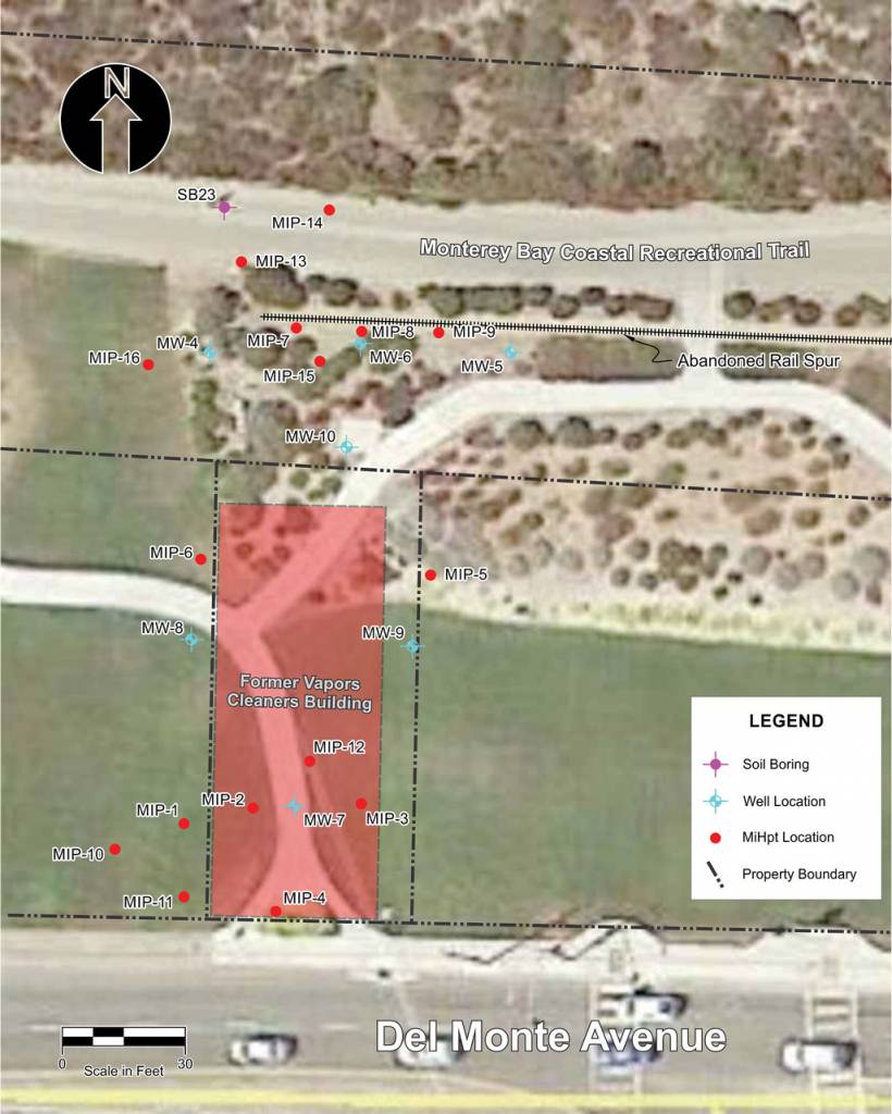
A total of 16 MiHpt locations were completed at the site. MiHpt locations MIP-1 through MIP-4, MIP-10, MIP-11, and MIP-12 were located in the general vicinity of Well MW-7 and the abandoned sanitary sewer line extending south from the former building location to Del Monte Avenue. MiHpt locations MIP-7, MIP-8, MIP-9, and MIP-13 through MIP-16 were located in the general vicinity of Well MW-6. MiHpt locations MIP-5 and MIP-6 were located east and west of the former building footprint, near the northern old wa
The City of Monterey, CA, has envisioned providing public access to the City’s waterfront by acquiring open space since the creation of the City’s Master Plan in 1939. One of these efforts is the Window on the Bay water front park project that runs alongside Monterey State Beach, Del Monte Avenue, and the Monterey Bay Coastal Recreational Trail. (City of Monterey, 2015)
Related Videos
ID: 6608
ID: 5344
ID: 1995
ID: 1979
ID: 1977
ID: 1965
ID: 1887
ID: 1908
ID: 1942