
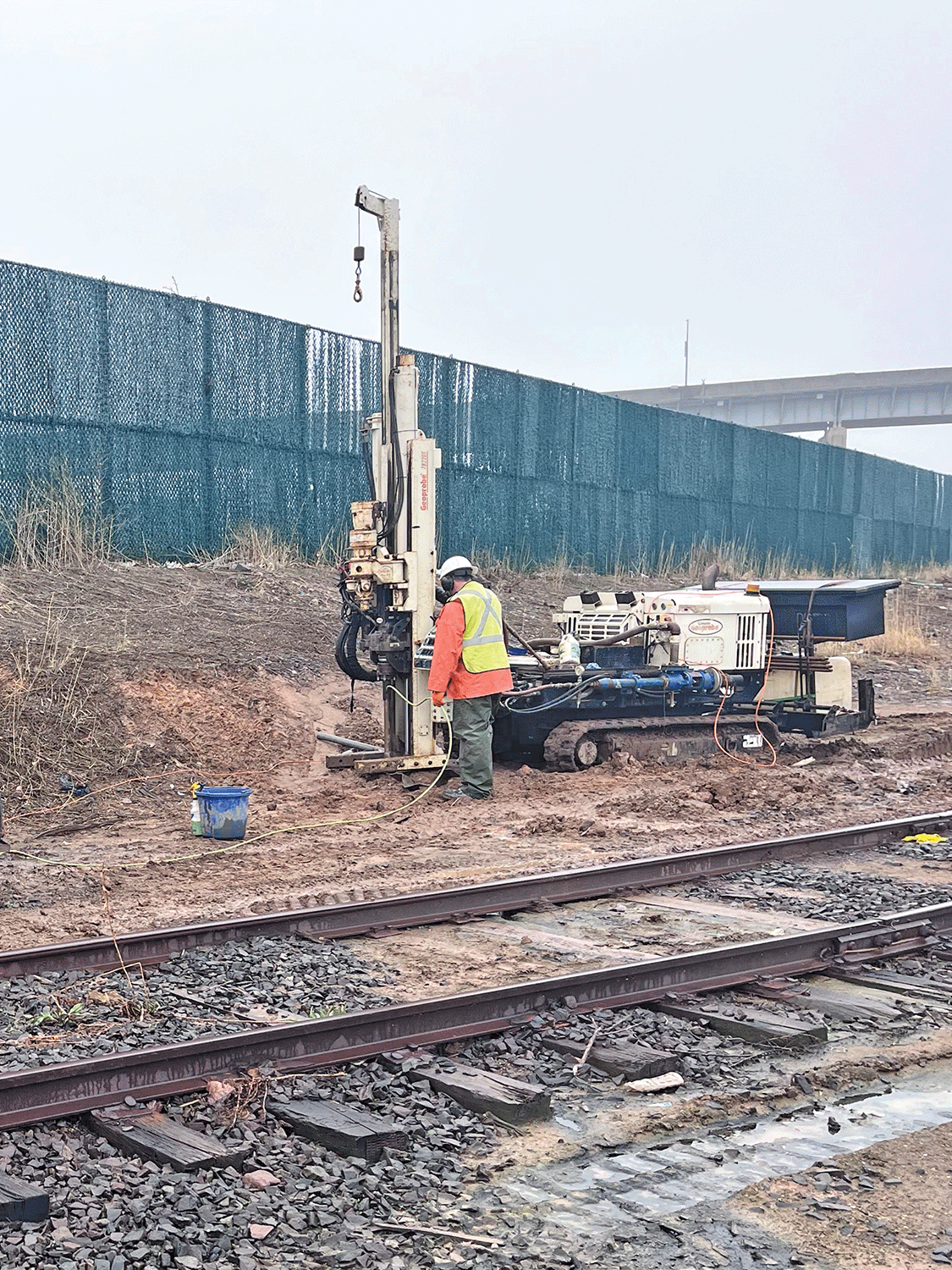
Geoprobe® Direct Image® sensing tool readings provide more high-resolution data than traditional monitoring wells, resulting in a more accurate conceptual site model and remediation plan.
S2C2 has seen it all! Since splitting off from a consulting firm in 1998, the company has gone through multiple iterations, changes in ownership, and shifts in staff. Through it all, one constant has remained: a commitment to delivering high-quality, high-resolution site characterization (HRSC) services.
From the beginning, S2C2 has been called upon to help solve nearly every type of subsurface environmental problem. However, the most frequent calls involve failed remediation efforts or consultants encountering light non-aqueous phase liquid (LNAPL) in wells previously believed to be clean.
“We get these calls three or four times a month,” Matthew Ruf, president, said. “As long as the contamination is in the overburden and within a formation a Geoprobe® direct push unit can push tooling through, we are confident we can help solve the problem.”
The Case for High-Resolution Data
S2C2 operates on the principle that all environmental problems are inherently complex. Accurately characterizing the relationship between contamination and lithology requires high-resolution data, something traditional investigation methods lack. Direct-sensing tools such as the Membrane Interface Hydraulic Profiling Tool (MIHPT) and Optical Image Hydraulic Profiling Tool (OIHPT) provide that level of detail.
“Monitoring wells are valuable for long-term observation, but they offer limited data, essentially one sample equals one data point, and longer well screens can dilute contaminant concentrations,” Ruf said.“In contrast, direct-sensing tools collect up to 20 readings per foot. More readings mean more data, and more data results in a clearer, more accurate subsurface picture.”
One Push, One Breakthrough
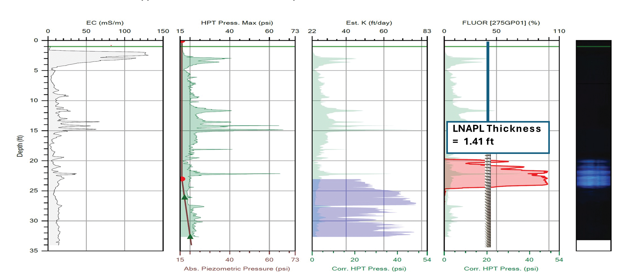
A recent project in New Jersey illustrates the power of this approach. An OIHPT log (Figure 1) from the site revealed critical insights that significantly altered the conceptual site model (CSM). The initial remediation plan called for injections across the entire well screen interval — 14–34 feet below ground surface. However, direct-sensing data showed that LNAPL was actually confined to a narrower zone between 19 and 26 feet.
With a single push, the understanding of the site changed completely. Remediation efforts could then be precisely targeted to the impacted interval, improving efficiency and effectiveness while saving money.
The Right Tool for the Job
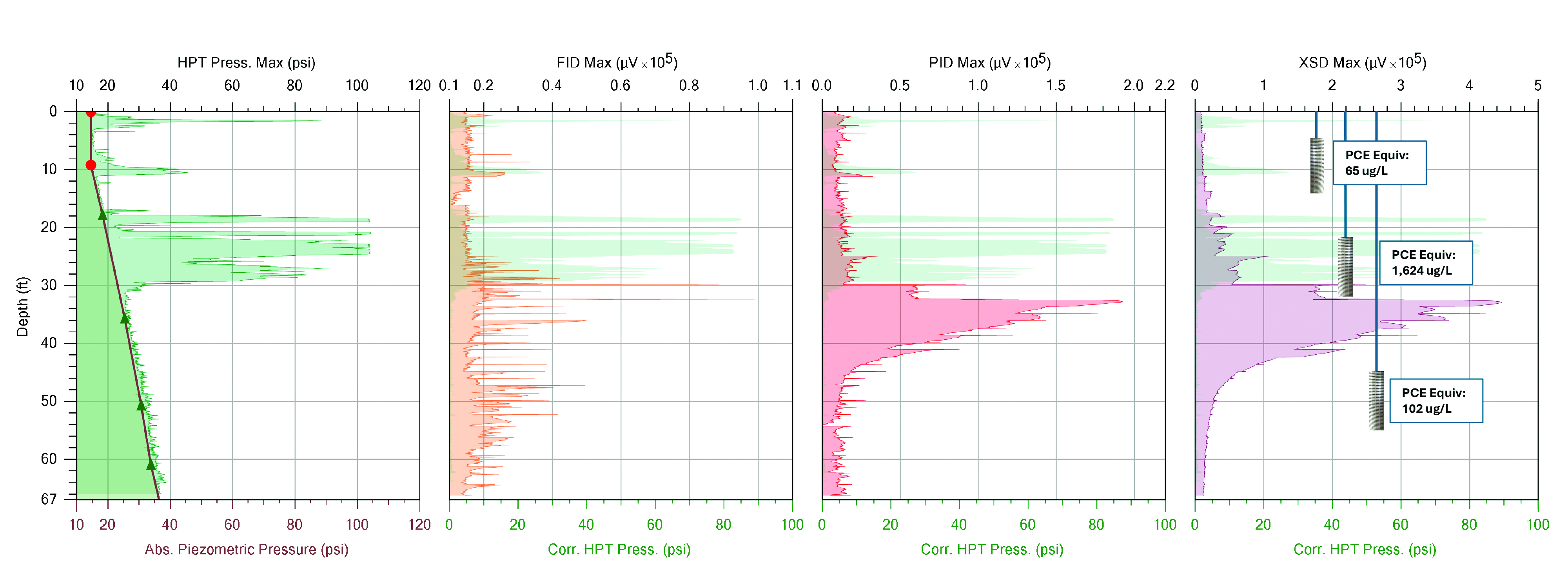
Tom Koester, S2C2’s senior high resolution site characterization specialist, feels ”MIHPT is the best tool for the job when dealing with chlorinated volatile organic compounds (CVOCs)”.
A recent MIHPT log demonstrates why (Figure 2). At another New Jersey site, a traditional investigation approach using monitoring wells detected impacts at each location, but the main CVOC plume was missed. The consultant reached out to S2C2 before an injection event to “double check” the characterization before injecting. The CSM changed after this MIHPT push resulting in a more targeted injection program.
“We feel that running a direct-sensing tool, whether it is MIHPT for CVOCs or OIHPT for LNAPL is the best money you can spend for your remedial efforts,” Ruf said.
Contact Us
1835 Wall Street
Salina, Kansas 67401
Phone: (785) 825-1842
Geoprobe® Direct Image® sensing tool readings provide more high-resolution data than traditional monitoring wells, resulting in a more accurate conceptual site model and remediation plan.